Breazeale History in Maps
Written by
Genealogy research is a hobby with a lot of layers. I was able to make quick progress initially, and I’m very grateful to the diligent genealogists who conducted their research before the internet and the early adapters who digitized sources for making a lot of my work fairly easy for me. What’s become interesting to me is finding my ancestors among the historical events and examining how history shaped their lives and how their lives shaped history.
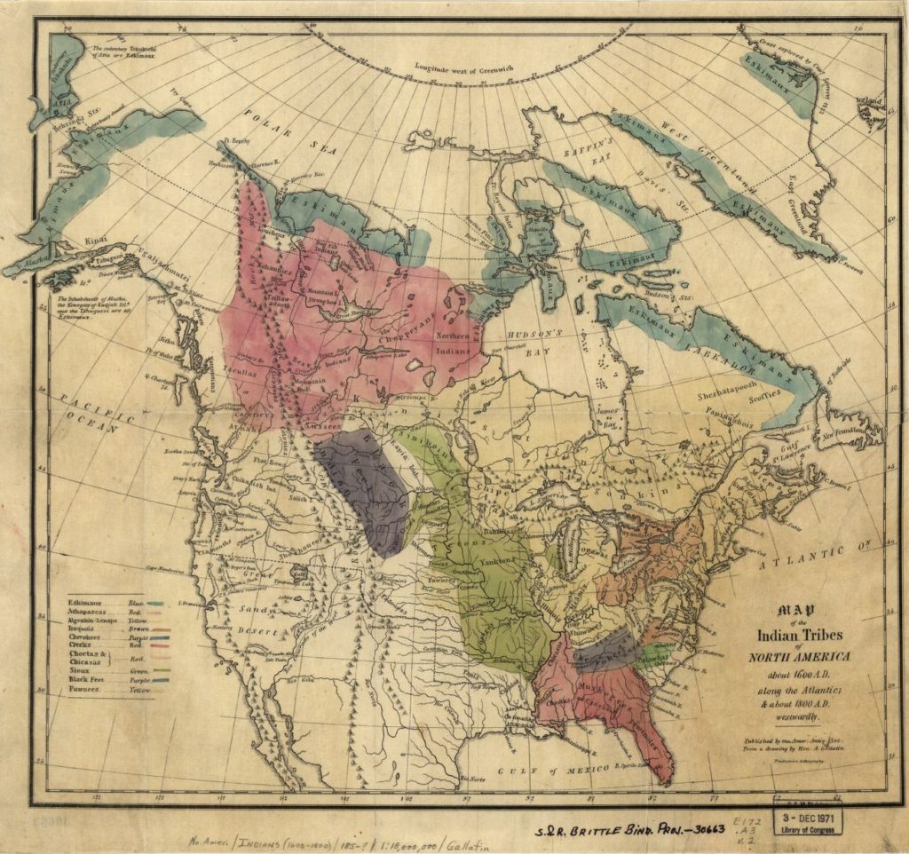
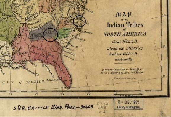
Here I’ve circled two areas relevant to the Breazeales in the seventeenth century: Jamestown, Virginia and the intersection of Cherokee, Muskogee, and Catawba land that was to become north-western South Carolina. We are certain that Henry Brazell was a property owner near present-day Richmond in 1679, and we’re pretty sure his father Henry Brassell immigrated through Jamestown in 1643. His son (yet another Henry) moved to South Carolina in 1764, and with him we move to the next map.
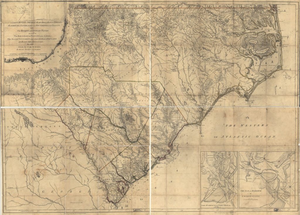
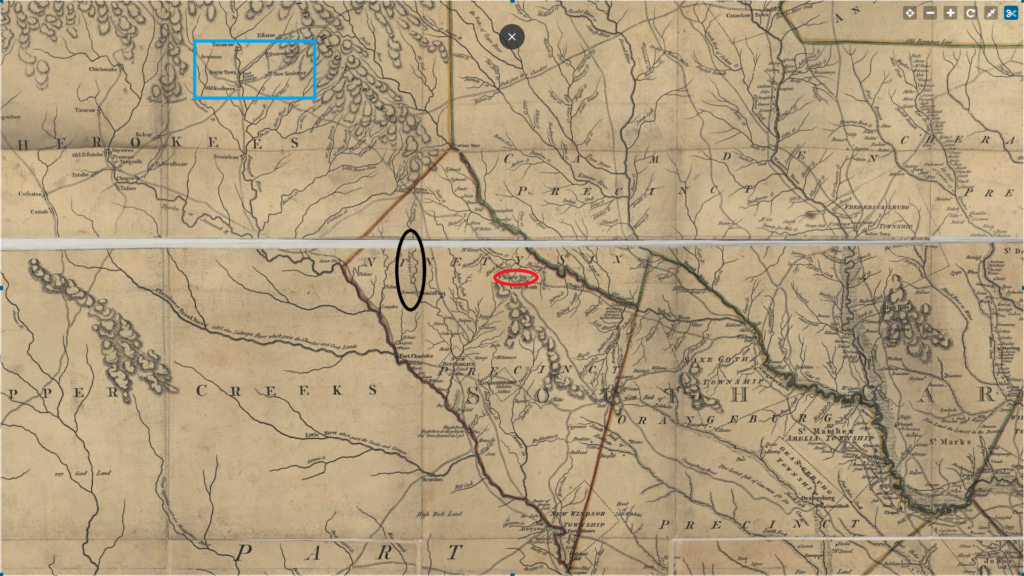
This Henry Breazeale received a grant of 200 acres on Long Cane Creek (circled in black) in what was then called Ninety-Six District, and although it’s anachronistic I think of him of the first of the Pickens Breazeales. I’ve circled the town of Ninety-Six in red, to my reading it’s the only place in the area that’s still a town in 2020. Long Cane Creek was on the boundaries with two other nations, the Cherokee to the north and the Creek (Muskogee) to the west. Just four years before in 1760 it had been the site of a Cherokee attack, known as the Long Cane Massacre. Catherine Calhoun, among the twenty three killed was grandmother of John C. Calhoun was killed there.
Examining the history of this time is like a nesting doll of armed conflicts amongst the settlers, Cherokee, British, and French. The Anglo-Cherokee war is dated 1758-1761, but it occurred within the timeline of the the French and Indian War in which the Cherokee allied with the British and they constructed Fort Prince George near the Cherokee town of Keowee (area circled in blue) where 23 Cherokee hostages were killed in 1758. I’ve seen no source comparing the two events, but I can’t help but see the symmetry in 23 deaths. These events are so minor in textbook history they may not even be footnotes, but for my ancestors and others I see the germs of experiences resulting in national and international policies that shape our world today.
Between 1775 and 1816, there’s significant variability in the maps of the region, specifically with the town of Keowee alternately being part of the US and Cherokee nation. In those 59 years, there were 21 treaties between Cherokee nation and the United States. The town of Keowee was largely razed during the Anglo-Cherokee war. Whatever artifacts or archeological understanding we could have had of when the Cherokee left the area permanently was submerged by Duke Power’s damn in 1970-71. The site of Fort King George were excavated before the damn was built, the site Keowee was not.
Pendleton District, South Carolina
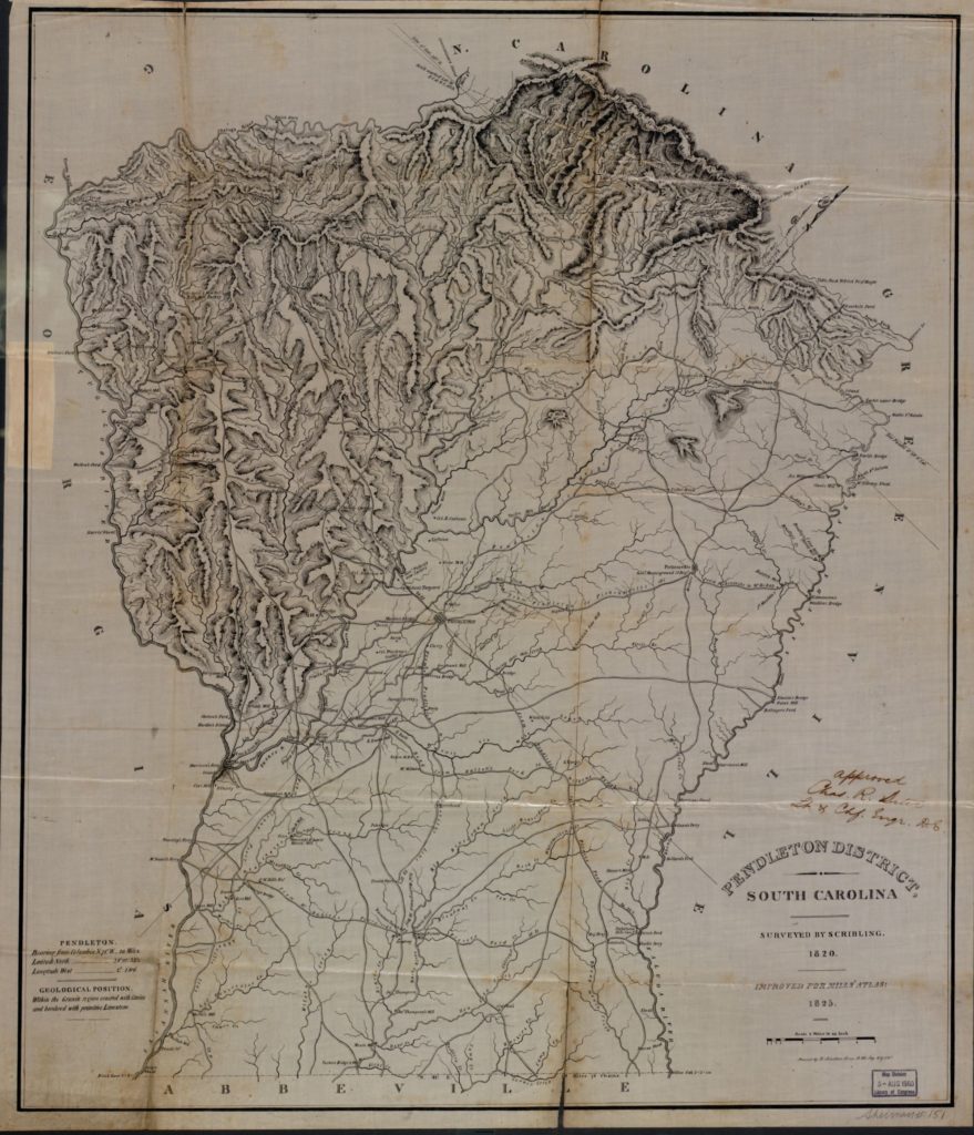
In 1820, we enter into a bit of a gap in our knowledge of the Breazeales and relatively few primary sources. We have the will of Henry Breazeale who died about 1767 and references a younger son, Willis Breazeale, who we see again in the 1790 census in Abbeville. The next Breazeale I’ve found in primary sources is Lucinda Breazeale, so far my most mysterious ancestor and our break in the patrilineal chain of Breazeale. In 1840, she is listed as the head of her household and lives with her mother and her children, with no male above 18 in the household. In 1850, she is on the census with her husband Robert Scott, her mother, and her children from before 1850 who keep the surname Breazeale. Presumably her father is George Washington Breazeale, who died in 1859 but was not living with his wife and daughter in either 1840 or 1850.
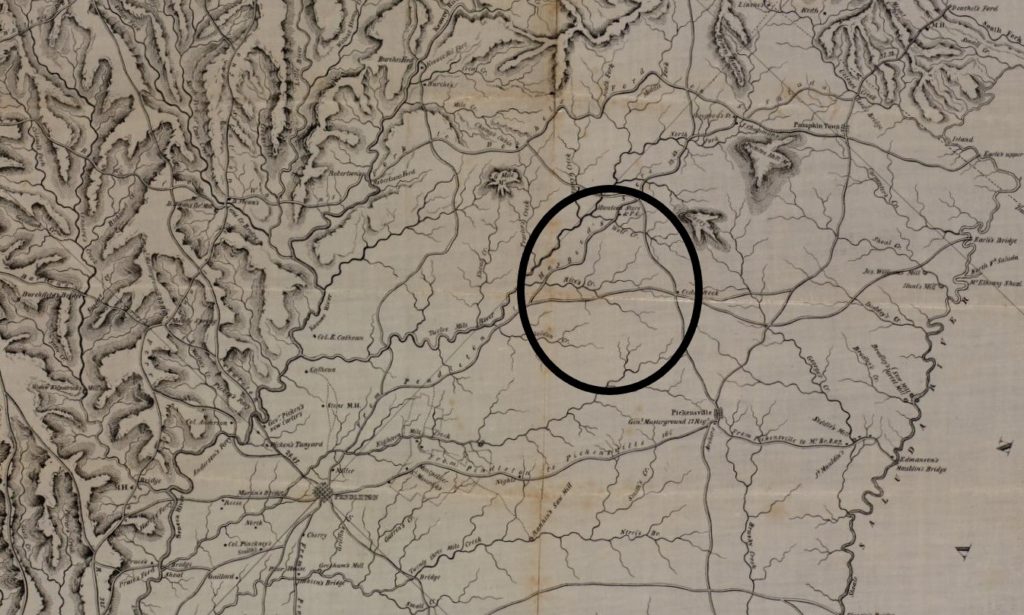
It’s in this period I confidently place my ancestry on land near the Twelve Mile River, near and likely including the land my parents live on today. Several other branches of my family settle to the west of Pickens during this time including the Bakers, Murphrees, Allgoods, and Bowens, many of whom are buried in Baker Cemetary.
South Carolina Railroads, 1900
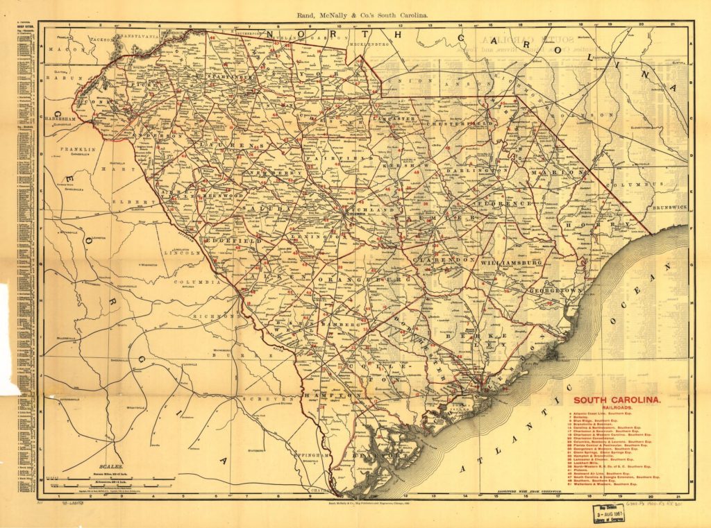
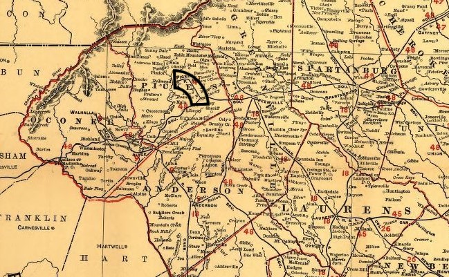
Skipping over some significant familial and national history, we jump to our next map in 1900. My great-great grandfather Samuel Perry Breazeale and great-grandfather Edward Thomas Breazeale are living, and a spur railroad has been built from Easley to Pickens and manufacturing entered the history of Pickens. My family kept up farming through the 1960’s but began adding manufacturing as a source of income.
Important farmlands map, Pickens County, South Carolina
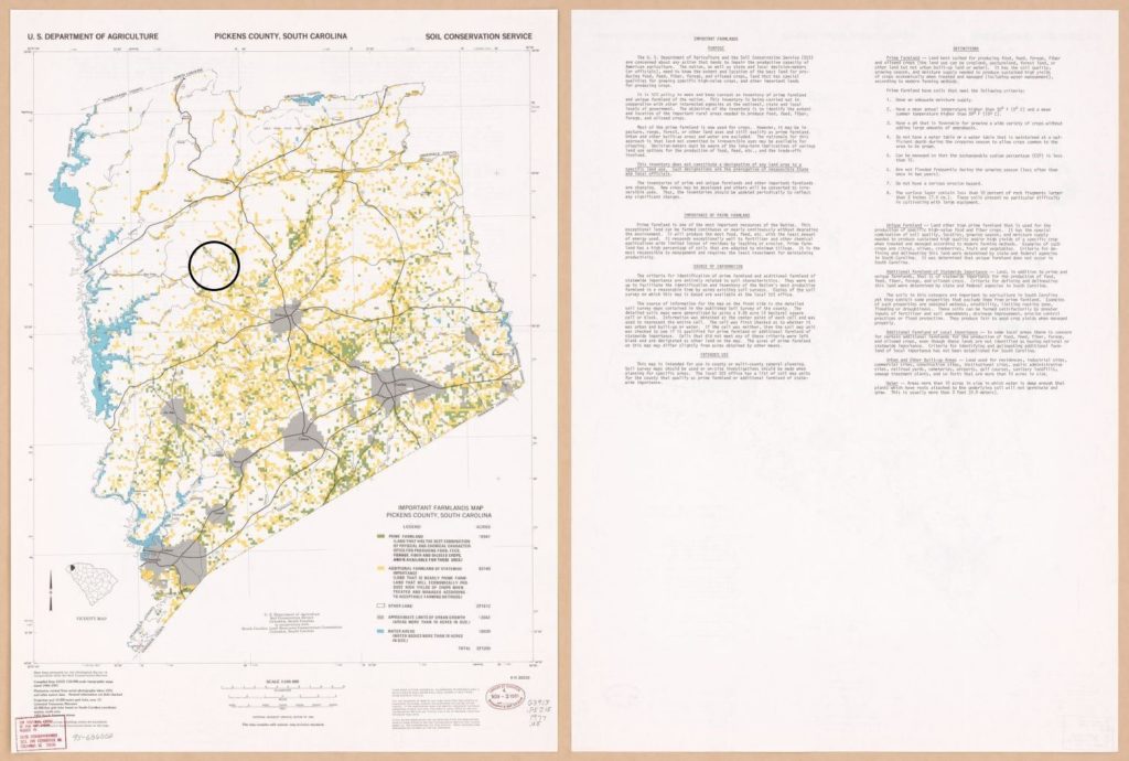
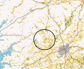
The final map is from the US Department of Agriculture in 1977. By this time my grandparents were retired, still living in their farmhouse. My dad was working at the timber mill, sending lumber down the Pickens spur line. It’s here I can clearly see the intersection of geography and history played out in my ancestry. The British in the eighteenth century and the Americans in the nineteenth century sent settlers to the edges of their borders with the Cherokee nation. Whether by gumption, a sense of manifest destiny, or happenstance the Breazeales settled on the westernmost boundaries. Pickens is a town in the foothills, and you can see the farmland begin to fade to white, giving way to rocky, thin Appalachian soil.
Join the discussion